|
|
Maps
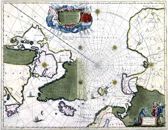 Joannes Janssonius (c. 1590-1664): Nova et Accvrata Poli Arctici et terrarum Circum Iacentium descriptio, Amsterdam 1657 (405 x 520). This polar chart's design and its use of cartouches is practically identical to Willem Blaeu's chart of 1635.
|

|
© University Library of Tromsø - 1999.
The Northern Lights Route is part of The Council of Europe Cultural Routes. The Cultural Routes are an invitation to Europeans to wander the paths and explore the places where the unity and diversity of our European identity were forged.
|

|