
|
|
Maps
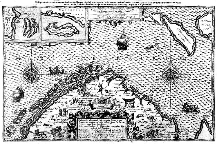
Lucas Waghenaer: Finmarchia, c. 1592. Waghenaer produced the first sea atlas, Spiegel der Zee-Vaerdt, in 1584. This was followed by a new atlas, Tresoor der Zee-Vaert (1592), where this sea chart shows Finnmark's coast for the first time. William Barentsz may have used this atlas on his journeys.
|

|
© University Library of Tromsø - 1999.
The Northern Lights Route is part of The Council of Europe Cultural Routes. The Cultural Routes are an invitation to Europeans to wander the paths and explore the places where the unity and diversity of our European identity were forged.
|

|