
|
|
Maps
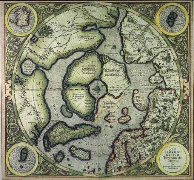 Gerard Mercator (1512-1594): Septentrionalium Terrarum descriptio (365 x 390). This polar chart was first printed in 1589. The copy originates from an edition of his posthumous 1606 atlas and has to do with the rediscovery of Svalbard (1596). Notice the partial map showing the imaginative land called Frisland.
|

|
© University Library of Tromsø - 1999.
The Northern Lights Route is part of The Council of Europe Cultural Routes. The Cultural Routes are an invitation to Europeans to wander the paths and explore the places where the unity and diversity of our European identity were forged.
|

|