|
|
Maps
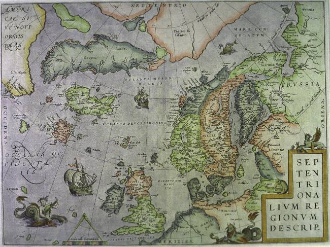 Abraham Ortelius (1527-1598): Septentrionalivm Regionvm descrip, Antwerp 1570 (365 x 490). This is the first map of Scandinavia that resembles what it portrays.
|

|
© University Library of Tromsø - 1999.
The Northern Lights Route is part of The Council of Europe Cultural Routes. The Cultural Routes are an invitation to Europeans to wander the paths and explore the places where the unity and diversity of our European identity were forged.
|

|